
Chapter 1
THE ABERDARE VALLEY.
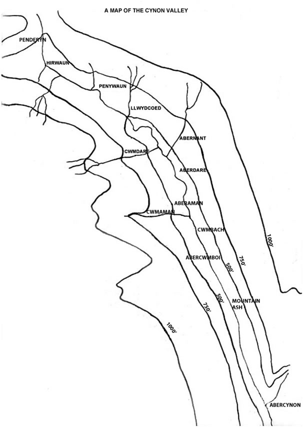
1. Location.
The Aberdare valley is situated in the north-east corner of upland Glamorgan. Through the main valley flows the river Cynon. This river rises in the village of Penderyn, Breconshire, on the lower slopes of the Brecon Beacons.
The River Cynon is about 15 miles in length. The area of land covered by the valley and its surrounding mountains is about 60 sq. miles.
To the north of the Valley lie the Brecon Beacons; to the west lie the twin valleys of the Rhondda; to the east lies the valley of the River Taff; to the south lies the coastal plain of the Vale of Glamorgan.
2. Formation of the Valley.
The River Cynon, which flows through the Aberdare valley, has its source in the village of Penderyn, but long ago the source of the river was much further to the north.
The ancestral Cynon had the rivers Hepste, Mellte and Nedd Fechan (Little Neath) as its tributaries. In Pliocene times (800-900,000 years ago), the above tributaries of the Cynon were captured by the headwaters of the Nedd Fawr (Big Neath) river. Before the river capture a much bigger river called the Perddyn flowed through the Aberdare valley thus making it wider and deeper than its neighbouring and parallel valleys of the rivers Rhondda and Taff.
During Pleistocene glaciation from approximately 500,000 to 50,000 years ago, South Wales was on the southern edge of the west European ice sheet. Tongues of ice from the upland area to the north, now called the Brecon Beacons pressed down towards the Hirwaun area. There, the tongues of ice were blocked by the giant Pennant sandstone scarp of Craig-y-Llyn and diverted into the valley of the Cynon and in doing so enlarging it. Erratic boulders in the boulder clay west of the village of Hirwaun testify to the Brecon Beacons being the source of the ice. Corrie glaciers occupied the amphitheatres of Llyn-Fawr, Llyn-Fach and Bwllfa.
The Second Glacial Age (500,000 years ago) appeared to have had the greatest effect in the physical geography of the Aberdare valley. It left thick deposits of boulder clay around Hirwaun, making a boggy, indeterminately drained landscape. It pushed down the valley to where Mountain Ash bridge is now, (10 miles), making the upper part of the valley very wide, but at the bridge it stopped and the glacier began to retreat, leaving a vast terminal moraine, which dammed the valley making a vast, narrow lake from the Dyffryn to the Gadlys, in so doing making a valley floor of successive layers of alluvium: gravel, pebbles and rich black silt, when ultimately the lake drained itself.
With the passing of the Fourth Ice Age and the amelioration of the climate of western Europe, the arctic fauna and vegetation passed away and the vegetation of a warmer climate gradually took its place. Firstly, probably the coniferous forest similar to that of Northern Europe; later by the deciduous forest of central Europe, mainly quercus sessiflora (oak forest) etc. This forest remained until historic times clothing the lower mountain slopes. The floor of the valley remained boggy and ill drained. This is reflected in the place names of the area: Cwmdare (Valley of the Oaks), Coedcae (wooded field), and Llwydcoed (the grey wood). The tops of the mountains remained bare, being covered only with poor grass and bracken.
Touring the area in 1807, Malkin described the area as: —
“... covered with luxuriant and majestic groves of oaks ...
... the very head-quarters of solitude”.
(“Economic Geography of the Aberdare Valley” - Thesis of J.Yockney - 1956).
Cynon Valley History Society is a Registered Charity. Charity No. 510143.
All information © Cynon Valley History Society